

Quick answer
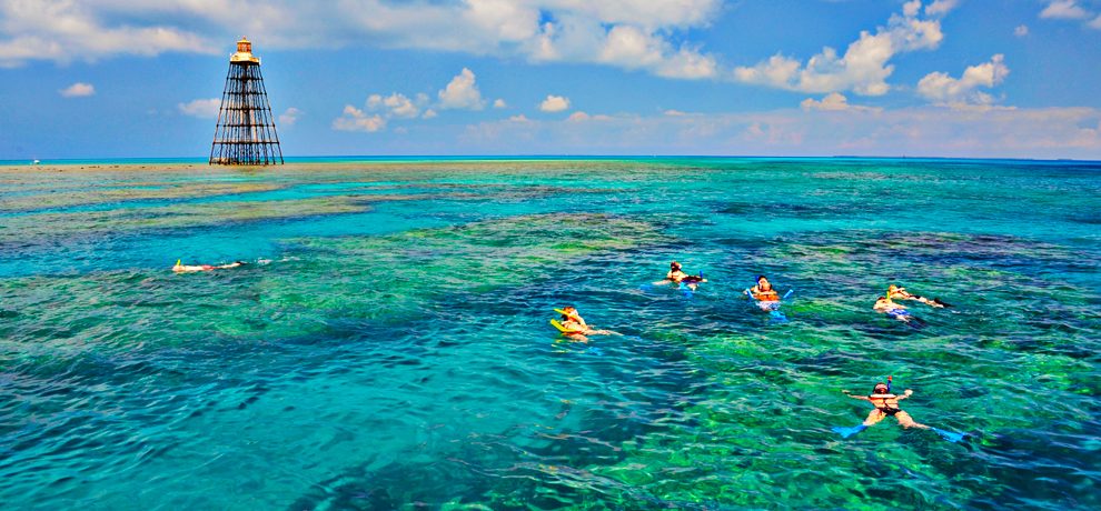
A key west snorkeling map marks sanctuary preservation areas, public mooring buoys, and the reef tracts accessible from shore or by boat. NOAA provides downloadable PDFs of official charts showing Sanctuary Preservation Areas like Western Dry Rocks and Sand Key, plus Wildlife Management Areas where seasonal closures apply. Paper charts and GPS apps overlay these zones with depth contours and navegational markers, helping you stay within legal boundaries and find coral formations without damaging the bottom.
The Florida Keys National Marine Sanctuary divides its waters into five protection zones, each with different anchoring and access rules that a snorkeler must know before entering the water. Sanctuary Preservation Areas prohibit all fishing and anchoring, leaving only mooring buoys for tie-up. Wildlife Management Areas close seasonally to protect nesting birds and turtle habitats. Ecological Reserves ban public entry entirely. A chart that labels these boundaries prevents accidental violations and steers you toward the mooring fields where boats cluster over the healthiest coral. Nautical charts published by NOAA show reef outlines as shaded polygons and mark public mooring buoys with magenta circles. Digital chart plotters and apps like Navionics or the NOAA Chart Viewer overlay your GPS position onto the same data, showing real-time distance to the nearest reef and current depth. Offshore reefs like Sand Key Reef and Rock Key sit three to six miles from shore, invisible from land, making a GPS-enabled device the only reliable way to navigate open water safely. Most boat launch ramps appear on the Key West harborfront and at Garrison Bight Marina. A key west snorkeling map guide identifies which ramps offer closest access to which reef tracts. Western Sambo Ecological Reserve lies southwest of Key West and remains off-limits. Eastern Dry Rocks and Marker 32 sit within reach of recreational boaters and show clearly on every marine chart. Shore snorkelers use maps to locate beach entry points like Fort Zachary Taylor, where shallow hardbottom extends a few hundred feet offshore before dropping into sand channels. Sanctuary staff update official charts annually to reflect new mooring installations and revised closures. Printed laminated charts sold at dive shops often include GPS coordinates for each mooring buoy, eliminating guesswork when you program a route. The sanctuary website offers downloadable KML files that import into Google Earth, letting you preview reef shapes and measure distances before launch. Cross-referencing multiple sources confirms that a site remains open and accessible under current regulations, reducing the chance of wasted fuel or a citation for trespassing into a protected zone.
“The Florida Keys National Marine Sanctuary divides its waters into five protection zones, each with different anchoring and access rules that a snorkeler must know before entering the water.”
Optimal Timing for Your Key West Snorkeling Map Visit
Optimal visibility and calm water conditions typically occur in the morning through early afternoon, making the best arrival window 09:00–14:00. Planning your snorkeling excursion during these hours ensures you experience the sanctuary when conditions are most favorable.
Weekday mornings
Minimal congestion—
Morning hours offer the calmest water surface for snorkeling.
April and May
ModerateWarm, 75°F–85°F
Spring brings stable water temperatures and reliable visibility.
October and November
ModerateWarm, 75°F–82°F
These months follow the peak heat, offering pleasant conditions.
Verdict: The best time to visit is during the weekday morning arrival window of 09:00–14:00, specifically throughout the months of April or October.
Entrance Fees and Costs for a Key West Snorkeling Map Experience
Access to the Florida Keys National Marine Sanctuary waters and the Eco-Discovery Center does not require an entry fee. Planning a snorkeling excursion involves costs related to private vessel transport or guided excursions.
Preparation Checklist for Your Key West Snorkeling Map Adventure
Pack strategically to make the most of your sanctuary exploration.
-
Bring reef-safe sunscreen — Chemical sunscreens damage coral; use mineral-based alternatives approved for marine sanctuaries.
-
Pack your own snorkel gear — Rental options are limited at some reef sites; a well-fitted mask improves comfort.
-
Download offline sanctuary maps — Cell service weakens offshore; pre-loaded maps ensure you can navigate channels and mooring sites.
-
Carry waterproof bags for valuables — Protect phone, keys, and ID from saltwater exposure during boat transfers.
-
Wear water shoes or reef booties — Sharp coral, sea urchins, and rocky shorelines require foot protection.
-
Bring a rash guard or wetsuit — Even in warm water, prolonged snorkeling can cause chilling; sun protection is a bonus.
-
Pack reusable water bottles — Hydration matters in subtropical heat; refill stations are available at the Eco-Discovery Center.
Check availability
Common Questions About Key West Snorkeling Map Logistics
Everything you need to know about key west snorkeling map